GIS are computer-based systems that enable users to integrate a range of geographic data to understand their environment. GIS are a fundamental and fast-growing part of the economy regionally, nationally and globally (c. £900M in UK economy in 2010, AGI).The evolution of the GI Industry has led to a global demand for a skilled work force that can use GIS to address a vast array of spatial issues.
To reflect the need for GIS specialists, many countries have implemented GIS within their school curricula. In the UK GIS is required in the GCSE Geography curriculum and recommended at Key Stage 3 and at A-level. However, despite GIS within the curriculum, there has been a lack of GIS use within classrooms around the world. While IT developments have mitigated many problems, teacher skills and confidence have remained an almost insurmountable obstacle. While teachers want to implement GIS they have demanded more training, ideas and materials that they can use with their classes.
While equipping established and newly qualified Geography teachers with GIS skills is an important area for development, there is a need for new Geography graduates to be equipped with the skills required by the GI industry. While GIS skills are important, many GIS jobs now seek graduates not only with computing skills but also with experience in training others.
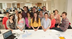
Ulster University has been at the forefront of addressing these issues by introducing GIS to Schools through a number of initiatives. The work is led by a multidisciplinary team from the School of Education and School of Geography and Environmental Science who have many years experience in GIS, remote sensing and education.
A range of initiatives have taken place ranging from students teaching GIS in classrooms with laptops and web-based maps to school pupils carrying out group activities on campus with staff and students from Ulster University. The team have also held several GIS Teacher Conferences whereby key skills and methods of delivery have been showcased.
To reflect the need for GIS specialists, many countries have implemented GIS within their school curricula. In the UK GIS is required in the GCSE Geography curriculum and recommended at Key Stage 3 and at A-level. However, despite GIS within the curriculum, there has been a lack of GIS use within classrooms around the world. While IT developments have mitigated many problems, teacher skills and confidence have remained an almost insurmountable obstacle. While teachers want to implement GIS they have demanded more training, ideas and materials that they can use with their classes.
While equipping established and newly qualified Geography teachers with GIS skills is an important area for development, there is a need for new Geography graduates to be equipped with the skills required by the GI industry. While GIS skills are important, many GIS jobs now seek graduates not only with computing skills but also with experience in training others.
Ulster University has been at the forefront of addressing these issues by introducing GIS to Schools through a number of initiatives. The work is led by a multidisciplinary team from the School of Education and School of Geography and Environmental Science who have many years experience in GIS, remote sensing and education.
A range of initiatives have taken place ranging from students teaching GIS in classrooms with laptops and web-based maps to school pupils carrying out group activities on campus with staff and students from Ulster University. The team have also held several GIS Teacher Conferences whereby key skills and methods of delivery have been showcased.
